Overview
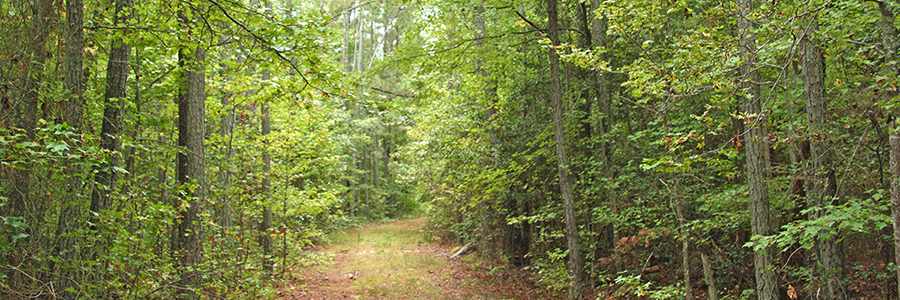
The 264-acre Crawfords State Forest borders the Chickahominy River and Schiminoe Creek in New Kent County. The forest’s pines and upland hardwoods are managed for multiple uses of timber production, wildlife habitat, research and demonstration, water quality protection, and passive recreation. The cypress swamps along the Chickahominy River were frequently described by naturalists in the late 1800s.
At a Glance
Access Status: Open to the Public
Hours: Open daily from dawn until dusk
Physical Address:
Latitude/Longitude:
37° 27’ 12.6”, -77° 4’ 48.6”
Parking/Access: Access to trailhead with small grass parking area 1.75 miles west of Providence Forge on the south side of Route 60 (Pocahontas Trail)
Restroom Facilities: None
Visitors are asked to adopt a “leave-no-trace” ethic when visiting the forest, as there are no restrooms or trash cans on the forest itself.
Other Facilities: None
Seasonal Closures: None


Crawfords became a state forest in 1995. Bessie R. Bowcock’s will (1988) set in motion the establishment of a ”bird and game sanctuary and nature trail” to honor the memory of her parents. Through trustees, the land initially went to the Virginia Outdoors Foundation, which later transferred it as a Deed of Gift with Retained Easement to the Virginia Department of Forestry.
Mrs. Bowcock was born a Richardson, a family with New Kent County roots back to 1700. Her father, R.E. Richardson was a well-known businessman and lumberman. By the time of his passing in 1929, he owned nearly 12,000 acres in New Kent County, making him the largest landowner in the county at the time. His wife, Julia Wickham Harrison Richardson, actually owned the tract of land called Crawfords, named for previous owners Ester and Norman Crawford. In land transactions prior to 1891, this same property was referred to as West Green Farm.
Old Timberland Examinations in DOF files suggest that most of the timber south of the railroad tracks had its origins in the 1920s and 1930s due to abandoned agricultural fields.
The forest is managed using scientific forest management practices and techniques, allowing it to serve as a demonstration forest, to sustain itself, and to benefit other forest resources.
Primary recreational uses of the Crawfords State Forest are hiking and wildlife viewing.
Visitors are asked to adopt a “leave-no-trace” ethic when visiting the forest, as there are no restrooms or trash cans on the forest itself.
ATV/ORV use, camping, and swimming are prohibited on all State Forests.
A State Forest Use Permit* is required for individuals aged 16 and older to hunt, fish, trap, horseback ride, or mountain bike on state forest lands. The permit can be purchased online or where hunting licenses are sold.
Trails and Roads
- 1.5 miles of forest trails (no vehicles)
- 0.8 miles of gated forest roads (no vehicles)
- No driving past forest gates.
Hiking
Hiking is permitted on trails and all forest roads.
Mountain Biking
Mountain biking is permitted on trails and all forest roads.
Horseback Riding
None
Fishing and Boating
None
Hunting and Trapping
None
Other Recreational Opportunities
Several geocaches are found on the forest. Other passive recreational activities, such as wildlife viewing and nature photography, are available.
- Self-learning opportunities are available.
For more information or questions, e-mail us or use our contact form.
State Forest Main Office
Located at Cumberland State Forest
751 Oak Hill Road, Cumberland, VA 23040-2511
E-mail | (804) 492-4121
Local Contact
Dennis Gaston, Forest Manager
11301 Pocahontas Trail, Providence Forge, VA 23140
E-mail | (804) 966-2209
| Image | Title | ID | Description | Content Type | View | hf:tax:document-category | hf:tax:Media |
|---|---|---|---|---|---|---|---|
 | Crawfords State Forest – General Map | General map of Crawfords State Forest. To ensure your safety and enjoyment, please read Before You Visit when planning your trip to a state forest. Download or print this state forest map – many state forests are remote with limited cell phone service. These maps will work with Avenza Maps™, a mobile map app that allows you to track your movements offline on your iOS and Android device without the need for cell service or internet connection. A free version of this app can be downloaded to your device through your app store. | Map | View | state-forests | map |