 So, you’re interested in seeing some of the beauty that is Virginia during fall foliage season but maybe you don’t want to fight the traffic that clogs some of the best-known places. You’ve come to the right place! We’re proud to provide our favorite DOF-recommended Fall Foliage Driving Tours. Who better than the folks who know Virginia’s trees best to provide you with routes that will expose you to some of the Commonwealth’s most colorful tree-lined vistas? Each of these tours – designed by a local DOF forester – is sure to exceed your expectations and fill your eyes with wide swatches of vibrant yellows, reds and oranges. These recommended drives are “off the beaten path” so you’ll be able to enjoy a leisurely trip without the hassles of a lot of traffic on the road.
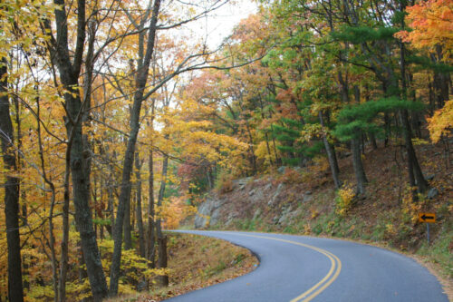
Enjoy “leaf-peeping” in Virginia!
From Stanardsville, intersection of Rt. 33 and Rt. 230
- Follow Rt. 230 north.
- At Rt. 29, turn left. Follow Rt. 29/231 and signs to Madison, exiting Rt. 29 along Rt. 231 at Madison.
- Follow Main Street in Madison.
- At the Blue Ridge Turnpike (Rt. 231), turn left.
- Take Rt. 231 to Sperryville, Rt. 522.
From Independence, at the intersection of Rt. 21 and Rt. 58:
- Take Rt. 58 West.
- At Volney, stay straight onto Rt. 16 North.
- In Troutdale, turn left onto Rt. 603 (Fairwood Rd.)
- Take a right onto Rt. 600 North to Chilhowie.
From I-81, Exit 247 (Rt. 33)
Follow Rt. 33 West:
- Follow Rt. 33 West to Brandywine Lake, which has restrooms, camping, fishing, and RV parking available.
- Returning on Rt. 33 East, turn right onto Rt. 613 and travel approximately 5 miles to visit Paul State Forest at the intersection of Rt. 613 and Rt. 257. The Paul is predominantly white oak. Follow Rt. 257 West to Hone Quarry, which has restrooms, camping, and RV parking available. Follow Rt. 257 East to Rt. 42; take Rt. 42 North to return to Rt. 33, or see Rt. 42 Fall Foliage Driving Tour below.
- After leaving Exit 247 on I-81, follow Rt. 33 to its intersection with Rt. 42 South in Harrisonburg.
- Turn left and follow Rt. 42 to Natural Chimneys, which has camping facilities and RV parking on the North Fork. Continue on Rt. 42 South from Mount Solon to Goshen.
Follow Rt. 33 East:
- Stay on Rt. 33 to Skyline Drive and the Blue Ridge Parkway.
- Travel 12 miles to Rt. 644 and follow signs to the Massanutten Resort. The resort offers chair lifts to the top of the mountain to observe the leaves, and have bands, arts, and crafts.
- Follow Rt. 602 to Rt. 636 West (left turn) to Cub Run Road, a distance of about 11 miles. You’ll find Catherine Furnace, a well-preserved Civil War pig iron forge. As you leave on Rt. 602, find Rt. 636 East and follow it to Rt. 340.
- Take Rt. 340 from the Town of Shenandoah in Page County to Port Republic. Portable toilets, provided by the Shenandoah Blueway Committee and the Virginia Department of Game and Inland Fisheries, are available at the pubic boat ramps at Island Ford, Lynnville, Port Republic, and Town of Shenandoah. The Shenandoah River Blueway is an excellent way to see the valley and its trees.
From I-81, Exit 279 (Edinburg)
- Proceed east on Stony Creek Boulevard to the Town of Edinburg in which fuel, drinks, and food can be purchased.
- Turn left onto Rt. 11 and proceed north for approximately seven-tenths of a mile.
- At Edinburg Motors, turn right onto Edinburg Gap Road (Rt. 675). This country road will first take you across the scenic North Fork of the Shenandoah River. Soon you will enter the George Washington National Forest and begin to climb in elevation. The tree canopy over the road provides a brilliant display of color. After crossing the first range of the Massanutten Mountain, you will arrive at the sleepy crossroads of King’s Crossing.
- At King’s Crossing, turn left onto Fort Valley Road. This scenic road will course lazily through the entire length of the long, but narrow Fort Valley. This small valley, located between two ranges of the Massanutten Mountains was named Fort Valley since it was a proposed hiding place for General Washington’s troops during the Revolutionary War.
- After traveling approximately 12 miles on Fort Valley Road, the road will once again enter the George Washington National Forest. Here the valley becomes very narrow and Passage Creek will be adjacent to the road in various places along the way. As you travel along this winding section of road, you will catch glimpses of a stone wall that separates Passage Creek from the roadbed. The boys of the Civilian Conservation Corps built this stone wall during the 1930s. This section of the National Forest also contains Elizabeth Furnace campground, a picnic area, and several hiking trails, including an interpretive trail to the ruins of Elizabeth Furnace, an 1800s iron production facility. This interpretive trail is accessed via the parking lot of the picnic area.
- Another short drive and the road will intersect Rt. 55. Turn left on Rt. 55 travel westward around the north end of the Massanutten Mountain range.
- Once again, you will be crossing the North Fork of the Shenandoah River and quickly thereafter entering the Town of Strasburg. Strasburg has many good restaurants, antique stores, and museums.
- From Strasburg, you can gain access to I-81 via Rt. 55 West or Rt. 11 North.
From Lexington I-81, Exit 191, follow I-64 to Rt. 39 to begin this tour.
- Follow Rt. 39 through Millboro Springs.
- At Rt. 629, turn left onto Rt. 629 and travel to Clifton Forge.
- At Clifton Forge, follow Rt. 220 South to Roanoke.
From Lexington I-81, Exit 191, follow I-64 to Rt. 39 to begin this tour.
- Follow Rt. 39 through Millboro Springs. At Rt. 629, stay on Rt. 39 to Warm Springs.
- Follow Rt. 39 to Rt. 603 (a gravel road), and take Rt. 603 to Lake Moomaw, Rt. 603 becomes Rt. 600 (paved).
- Take Rt. 600 to Rt. 39, and turn right to return to Warm Springs.
Note: If you stay on Rt. 600, you can follow Rt. 84 and then Rt. 640 to Hightown in Highland County, and connect to take the Staunton Area – Highland County driving tour. Take Rt. 220 North to Monterey in Highland County.
I-66, Exit 6 (to Front Royal/Winchester)
- Turn onto Rt. 340/522 South towards Front Royal. As you enter Front Royal, you will be able to see a vista of the Blue Ridge Mountains and cross over two bridges – first over the North Fork of the Shenandoah River, then the South Fork.
- After the second bridge, use the middle lane at the traffic light to turn left onto 14th Street and continue following Rt. 340 South.
- Passing through Front Royal, there are many opportunities for fuel, drinks/food, and sightseeing, as well as the Front Royal/Warren County Visitors Center at 414 East Main Street.
- Once you have gone past the entrance to Shenandoah National Park, turn left at the traffic light onto Browntown Road. This winding, forested road will take you along the base of Skyline Drive and will offer opportunities to see the mountains from within the valley as you make your way to the area of Browntown.
- After 7.5 miles, you will enter what is known as Browntown, with Gooney Run flowing adjacent to the road. This tucked-away community of Warren County has small churches, a community center, and the O.J. Rudacille General Store, which has been serving the community since 1884.
- Turn right onto Bentonville Road, crossing over a one-lane bridge, and the general store will be on your left. Follow Bentonville Road for 6 miles until you reach Rt. 340 in Bentonville.
- Once you turn right onto Rt. 340 North to head back into Front Royal, there are options for fuel, drinks, and food.
- After 1 mile, Shenandoah River State Park will be on your left. The park has a short 1.5-mile drive down to the Shenandoah River and has an overlook along the way featuring a view the Shenandoah River and the Blue Ridge Mountains. *There is an entrance fee.
- Continuing north on Rt. 340, you will gain access to I-66.
(Approximately 1 hour, 15 minutes)
Rt. 460 in Bedford, take Rt. 122 South to Moneta
- In Moneta, on Rt. 122, travel east on Rt. 608 about 10 miles to the Bourassa State Forest.
- Travel back to White House intersection on Rt. 608 and turn south on Rt. 626.
Go about 2.1 miles to Smith Mountain Lake State Park entrance. - Continue another 3 miles on Rt. 626.
- Side routes: From Moneta, travel south on Rt. 122 about 4 miles to Halesford Bridge.
Cross the lake for food and gifts. - From Moneta, travel north on Rt. 122 about 15 miles to visit the Visitors’ Center and D-Day Memorial in Bedford.
(Roundtrip from Moneta, approximately 35 miles)
From New Castle, I-81, Exit 141 near Salem
- Follow Rt. 311 for 19.2 miles to New Castle. Turn west onto Rt. 42 in New Castle.
- On the right corner of Rt. 42 and Rt. 311 is the first of several beautiful old Victorian houses leading out of New Castle. This house was built by Senator George W. Layman in the late 1890s. Next to it is the New Castle Methodist Church. Across the street, behind the Craig Automotive garage on the left corner of Rt. 42 and Rt. 311, is the oldest home in New Castle. It was Union General David Hunter’s headquarters when his army of 21,000 camped in New Castle June 22-23, 1864. On the right, just before starting up the mountain, is a lovely Victorian, locally called “the castle”.
- Two miles up the mountain on the left is the “Lookout” presenting a majestic view of New Castle and four mountain ranges beyond.
- Rt. 42 continues to climb through a gap between Johns Creek Mountain (where you are now) and Sinking Creek Mountain to the left. Meadow Creek Falls, also called by its older name of Buttermilk Falls, (cannot be seen from the road at the present but an overlook is planned), tumbles nearly 1,000 feet down to Craig Creek on the southern edge of New Castle.
- Next is Rt. 624 on the right. Keep going on Rt. 42 about 5 miles from New Castle to the community of “Looney”, so called for the earliest settlers and the post office stores, tan yard, blacksmith shop, harness maker, school, and church.
- Turn right just before the Chestnut Grove Church (1877), onto Rt. 645. On the right is the old Looney School (1883 – 1946), restored by the Sam Lowrey family. A tenth of a mile from Rt. 42 on the left is “Mag’s” (Abbott) store.
- Turn right onto Rt. 623 and go 1.1 miles to Rt. 624.
- Turn left on Rt. 624. In about 3 miles is the continental divide where all waters flowing west run into the Gulf of Mexico and all running east flow to the Atlantic Ocean. Here, Sinking Creek runs west and Meadow Creek runs east.
- On up Rt. 624 about another 2 miles on the left is Mount Carmel Church, built by the Caldwell family in 1899.
- One-tenth of a mile beyond on the right is a big tan house with brown shutters situated against Johns Creek Mountain. This was the home of William “Ad” Caldwell who walked 28 miles from here over the mountain to Blacksburg to enroll as the first student of Virginia Tech, October 1, 1872. His brother “Mick” enrolled as the second student.
- About three-tenths of a mile on the left is Rt. 625 which leads 2.3 miles back to Rt. 42. At the stop sign, look to the left to find the William Addison Caldwell Historical Marker at a two-story brick colonial called the “old Wiley” home.
- Turn right onto Rt. 42. A short drive brings the tour past a U.S. Forest Service road on the left called “Hall Road” which crosses Sinking Creek Mountain to Rt. 621 on Upper Craig Creek. Next is Sinking Creek Store on the left. About 2 miles beyond on the right are the twin churches, Bethel Christian (1912) and Bethel Methodist (1870).
- Turn right at the churches onto Rt. 626, which meanders about a mile and a half over Sinking Creek back to Rt. 624. (This point where the tour turns back onto RT. 624 is not quite 3 miles beyond Rt. 625 where the tour cuts back onto Rt. 42.) About 1.5 miles farther west on Rt. 624 is the nearly 100-year-old Trout School on the left. The fields surrounding it served as a fairgrounds in the early 1900s. On the right is the old Trout home with beautiful maples along the lane. Three-tenths of a mile further is the Woodall Blueberry farm. Six-tenths further, Rt. 624 ends at Rt. 42.
- A left turn onto Rt. 42 leads past the old Maywood school 2.5 miles back to the twin churches. Turn right onto Rt. 42 for three miles through Simmonsville which was a very prosperous spot with a store, post office, millinery, blacksmith shop, tan bark house, school, and Gravel Hill Church (1835). Next on the right is the Simmonsville Fire Department.
- Nine-tenths of a mile further is Rt. 658 which turns right through Happy Hollow, over Johns Creek side. Coming out of the trees near the bottom of the mountain is a majestic view of land that was cleared by what was the Tri-State Lumber Company. At the bottom of the mountain Rt. 658 runs into Rt. 632.
- Turn right onto Rt. 632 and drive less than a mile to “Maggie”, so named after the postmistress, Maggie Tingler. A left turn onto Rt. 658 takes you to the Johns Creek Fire Department and the Forks of Johns Creek Church is located on the right. Staying on Rt. 632, follow Maggie’s 9.6 miles of twisting road along beautiful Johns Creek. Rt. 632 and Rt. 658 intersect again.
- Turn right onto Rt. 658 and travel 4.7 miles to Rt. 311 at the foot of Potts Mountain.
- Turn right onto Rt. 311 and travel 5 miles over Peter’s Hill and end your tour at the starting point in New Castle.
From Boones Mill on Rt 220 (about 20 minutes South of Roanoke)
- Turn west onto Rt. 739 (Bethlehem Road) on the north side of the Shell Station. As you travel along Rt 739, Cahas Mountain is on the right. Near Fairmont Baptist Church Rt. 739 turns right, but you should stay on Bethlehem Road, which is now Rt. 643.
- At Callaway Road (Rt. 641) turn right. The Blue Ridge Mountains can be seen in the background as you drive to Callaway.
- At the A & A Market in Callaway, stay on Callaway Road, which now is Rt. 602.
- At 0.2 miles, turn left onto Rt. 642 (Foothills Road) at the Piedmont Presbyterian Church.
- Follow Foothills Road until it intersects with Five Mile Mountain Road (Rt. 748)
- Turn right onto Five Mile Mountain Rd. (Rt. 748). The Blue Ridge Mountains can be seen in the background.
- At Rt. 640 (Turner’s Creek Road), you have the option of (1) turning left and traveling to Ferrum or (2) staying on Five Mile Mountain Road (now Rt. 640), which will take you into Floyd County.
Note: At Ferrum you can visit the Blue Ridge Institute and/or Ferrum College, both of which are located on Rt. 40 to the left of the intersection of Turner’s Creek Road and Rt. 40. At the Phoebe Needles Center, Turner’s Creek Road changes to Rt. 748. From Ferrum, take Rt. 40 east to Rocky Mount and Rt. 220 north back to Boones Mill to complete the loop or take a ride on Virginia’s Heritage Music Trail, The Crooked Road, on Rt. 40 west.
Note: You can pick up the Blue Ridge Parkway off Rt. 640, approximately 1.5 miles from the Floyd/Franklin county line. Left (south) on the Parkway goes to Mabry’s Mill and points south, and right goes back to Roanoke.
The Highland County Driving Tour starts in Staunton. At Exit 222 on Interstate 81 near Staunton, follow Rt. 250 to Monterey. This tour begins as you cross the Highland County line.
At Monterey, travel west on Rt. 250 to Hightown.
- Travel west on Rt. 250 to the West Virginia State Line. Turn around and head back to Hightown.
- Travel west on Rt. 250 to the West Virginia State Line, and travel into West Virginia to Rt. 92. Follow Rt. 92 South to Rt. 84 to return to Virginia. Rt. 84 North will take you back to Hightown. (Approximately 1 hour, 20 minutes.)
- Follow Rt. 640 North from Hightown to Rt. 637, and follow Rt. 637 South to return to Hightown. (Approximately 30 minutes.)
Highland County to Bath County
- At Hightown, follow Rt. 640 to Rt. 84 to Rt. 600 and travel into Bath County.
- Follow Rt. 600 to Lake Moomaw.
- Follow Rt. 603 (a gravel road) through Bacova to Rt. 39.
- Take Rt. 39 to Warm Springs
- Take Rt. 39 East to Lexington, OR
- Follow Rt. 220 North to Monterey