Overview
Moore’s Creek State Forest sits in a beautiful high-elevation valley in Rockbridge County, just outside Lexington. The 2,353-acre tract features mountain vistas, scenic trails, and abundant wildlife, including black bear, wild turkey, and a host of migratory songbirds. It is managed primarily for watershed protection and recreation.
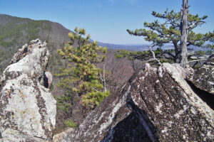
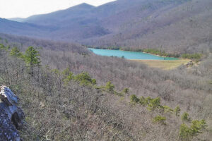
The forest contains the headwaters of Moore’s Creek, and Lexington Reservoir is in the center of the state forest. The reservoir and immediate lands surrounding it are the property of the City of Lexington. Moore’s Creek above the reservoir provides habitat for trout. A large rock formation overlooks the reservoir and state forest. The property is adjacent to the George Washington and Jefferson National Forest.
At a Glance
Access Status: Open to the Public; but no direct access
Hours: Open daily from dawn until dusk
Physical Address:
Latitude/Longitude:
37° 44’ 54”, -79° 39’ 24”
Parking/Access: Only access is by parking on and hiking across the George Washington and Jefferson National Forest. From the intersection of Routes 11 and 60, in Lexington, head southwest on Route 11 for 0.9 miles; continue straight onto Route 251 north for 5.6 miles; continue straight onto Route 677 for 1.9 miles; continue onto Route 612 for 8.3 miles; make a right (North) onto USFS Road 3079.
Parking is available at the end of USFS Road 3079 (1 mile to large gate) in a couple of pull-offs along the road.
Walk down the hill past the gate, cross Smith Branch, and the first trail on your right will take you to Moore’s Creek State Forest.
Restroom Facilities: None
Visitors are asked to adopt a “leave-no-trace” ethic when visiting the forest, as there are no restrooms or trash cans on the forest itself.
Other Facilities: None
Seasonal Closures: The USDA Forest Service does not clear USFS Road 3079, so the Moore’s Creek State Forest may be inaccessible due to snow in winter.
DOF recommends that all forest visitors wear blaze orange or pink during hunting seasons.
Moore’s Creek became a state forest in 2010. DOF purchased it from the City of Lexington in 2008 with monies from the State Conservation Bond Fund. The city used the land primarily to protect the watershed around the city’s reservoir, but did conduct some timber harvesting below the south end of the lake, around the year 2000.
Having no direct management or public access to the forest has limited the amount of forest management on the Moore’s Creek State Forest. Recreational trail development and maintenance, along with some trout stream habitat improvements, comprise the bulk of forest management activities. The mixed hardwood forest provides watershed protection for the Lexington Reservoir.
Recreational uses of the Moore’s Creek State Forest are limited to primarily passive recreation, such as hiking and wildlife watching, due to accessibility issues.
The only access is by hiking from the George Washington Jefferson National Forest.
Visitors are asked to adopt a “leave-no-trace” ethic when visiting the forest, as there are no restrooms or trash cans on the forest itself.
ATV/ORV use, camping, and swimming are prohibited on all State Forests.
A State Forest Use Permit* is required for individuals aged 16 and older to hunt, fish, trap, horseback ride, or mountain bike on state forest lands. The permit can be purchased online or where hunting licenses are sold.
Trails and Roads
- 5 miles of forest trails (no vehicles)
- 2.8 miles of gated forest roads (no vehicles)
- No driving past forest gates.
Hiking
Hiking is permitted on all forest roads and trails.
The only access is by hiking from the George Washington Jefferson National Forest.
Mountain Biking
None
Horseback Riding
None
Fishing and Boating
The only access is by hiking from the George Washington Jefferson National Forest.
The City of Lexington owns the reservoir and associated dam. To fish in the reservoir purchase an annual State Forest Use Permit.
The headwaters of Moore’s Creek (above the Reservoir) can be fished in accordance with state fishing regulations. Both a State Forest Use Permit and Virginia fishing license are required.
Hunting and Trapping
The only access is by hiking from the George Washington Jefferson National Forest.
Hunting and trapping are permitted with a valid State Forest Use Permit and valid hunting/trapping license in accordance with state regulations. Note that some regulations may be different than on private land, so check Virginia Department of Wildlife Resources Hunting Regulations for specific state forest details.
Other Recreational Opportunities
Other passive recreational opportunities, such as wildlife watching and nature photography, are available.
- Self-learning opportunities are available.
For more information or questions, e-mail us or use our contact form.
State Forest Main Office
Located at Cumberland State Forest
751 Oak Hill Road, Cumberland, VA 23040-2511
E-mail | (804) 492-4121
Local Contact
Zach Olinger, Forest Manager and Education Specialist
106 Forestry Lane, Galax, VA 24333
E-mail | (276) 236-2322
| Image | Title | ID | Description | Content Type | View | hf:tax:document-category | hf:tax:Media |
|---|---|---|---|---|---|---|---|
 | Moore’s Creek State Forest – General Map | General map of Moore’s Creek State Forest. To ensure your safety and enjoyment, please read Before You Visit when planning your trip to a state forest. Download or print this state forest map – many state forests are remote with limited cell phone service. These maps will work with Avenza Maps™, a mobile map app that allows you to track your movements offline on your iOS and Android device without the need for cell service or internet connection. A free version of this app can be downloaded to your device through your app store. | Map | View | state-forests | map | |
 | Moore’s Creek State Forest – Hunting Map | Hunting map of Moore’s Creek State Forest. To ensure your safety and enjoyment, please read Before You Visit when planning your trip to a state forest. Download or print this state forest map – many state forests are remote with limited cell phone service. These maps will work with Avenza Maps™, a mobile map app that allows you to track your movements offline on your iOS and Android device without the need for cell service or internet connection. A free version of this app can be downloaded to your device through your app store. | Map | View | state-forests | map | |
| Moore’s Creek State Forest Hunting Season Brief | This information sheet provides a brief summary about hunting season in Moore’s Creek State Forest, including various hunting seasons, dates and times. Visit Department of Wildlife Resources for full hunting regulations and seasons. | Document | View | state-forests | document |


