Notice: The Brumley Mountain Trail to the Channels is now open. We ask hikers to stay on the trail and avoid storm-damaged areas.
Notice: The parking area at Channels Natural Area Preserve is limited to 10 vehicles. If the parking area is full when you arrive, please come back another time. Parking along Highway 80 is not permitted and violators will be ticketed.
Overview
Channels State Forest covers 4,836 acres in Washington and Russell counties. Management focuses on demonstration of scientific forest management, applied forest research, development of diverse wildlife habitat, watershed protection, biological diversity, and passive outdoor recreation.
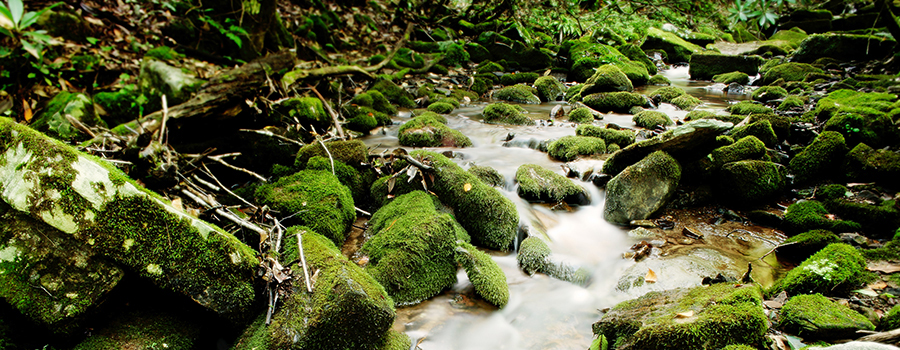
With elevations ranging from 1,800 feet to over 4,200 feet above sea level, the Channels State Forest encompasses a diversity of forest types, with several hardwood types predominant. Several intermittent and perennial streams flow through the forest.
At the crest of the mountain, within the Department of Conservation and Recreation’s Channels Natural Area Preserve, are the 400-million-year-old Great Channels of Virginia. This impressive formation is a sandstone outcropping where geologic processes have created deep crevices or “channels” in between very large residual boulders.
The property owned privately prior to The Nature Conservancy acquisition and subsequent purchase by the Commonwealth of Virginia, was referenced in a book called Fire Tower by Jack Kestner who staffed a fire tower found on the property when towers were manned in Virginia.
The Department of Wildlife Resources has two Wildlife Management Areas (WMA) close by: Hidden Valley WMA lies just to the west while the Clinch Mountain WMA is a few miles to the east. The forest, WMAs, and a number of privately-owned lands with conservation easements, combine to make up more than 50,000 acres of conserved forestland in the area.
At a Glance
Access Status: Open to the Public
Hours: Open daily from dawn until dusk
Physical Address:
Latitude/Longitude:
36° 49’ 40.9”, -81° 57’ 43.5”
The Channels State Forest is located on the south slope of Clinch Mountain, situated primarily in Washington County, approximately 8 miles due north of Abingdon. The property lies just north of Route 689 (Brumley Gap Road) and west of Route 80. A small portion of the forest (30 acres), extends over the top of Clinch Mountain into Russell County; north and east of Middle Knob.
Parking/Access: Access from Route 689, and Route 80. There are three parking areas along the North-South Road and a parking area along Route 80 at the trailhead that is the most common hiking route to the Channels. A small parking area adjacent to Route 80 near the Washington and Russell County Line can accommodate 10 cars, with an additional parking area north of Route 689 across from Fletcher’s Chapel.
Restroom Facilities: None
Visitors are asked to adopt a “leave-no-trace” ethic when visiting the forest, as there are no restrooms or trash cans on the forest itself.
Other Facilities: None
Seasonal Closures: None


The Channels State Forest was established in 2007. Prior to that, the property was privately owned and used primarily for hardwood timber production and recreation. Much, if not most, of the mature timber on the property had been harvested in the 20-25 years prior to state ownership.
Funds for the acquisition of Channels State Forest came from the Virginia Land Conservation Foundation (VLCF) and the Virginia General Assembly (2007 Session). The property, by deed restriction, was dedicated for the conservation of forested natural resources, as well as the preservation of open space under the Open-Space Land Act. A Deed of Dedication on approximately 721 acres within the state forest created a Natural Area Preserve jointly managed by the Virginia Department of Forestry and the Virginia Department of Conservation and Recreation – Natural Heritage Division.
Historical Landmarks
The Great Channels of Virginia, a 400-million-year-old sandstone outcrop, is located within the Natural Area Preserve.
Forest types range from cove hardwoods to dry pine-hardwood mixes. There are eastern hemlocks in the drainages, some scattered pitch and shortleaf pines, and a stand of planted white pine. Specific species groups include upland hardwoods, Northern red oak, cove hardwoods, pine-hardwood mix, high-elevation cove, white pine, and open/other. Like most of the southern and central Appalachians, what is now the state forest was timbered heavily, and in many cases, high-graded, during previous ownerships. These practices diminished stand quality and forest productivity. The process of restoring productive forest stands is a long-term endeavor and very challenging, but it presents a tremendous opportunity to demonstrate sound forest management to the public.
A rich diversity of plant species are found on the Channels State Forest. The overstory is comprised primarily of mixed oaks, yellow poplar, and red maple. Other trees that can be found in abundance include: cucumber tree, Fraser magnolia, blackgum, sourwood, sassafras, sugar maple, ash, mixed hickories, black birch, yellow birch, black cherry, eastern hemlock, and shortleaf, Virginia, and pitch pines. The understory consists of a mixture of woody and herbaceous plants. Rhododendron is very common along the drainages, and mountain laurel forms dense thickets covering hundreds of acres along the drier ridgelines. A great variety of ferns and small plants cover the forest floor. Many types of wildflowers can be seen in bloom throughout the spring and summer. In particular, the old home site along Whiterock Branch, in the Natural Area Preserve, sustains an abundance of herbaceous species.
Red spruce (Picea rubens) exists in two small, remnant stands along the crest of Brumley Ridge. Historically, spruce covered many of Virginia’s higher mountains, but it has been greatly reduced in the last century by clearcutting and fire. It is also suspected that climate change is playing a role in the diminishing areas where red spruce grows. Historical photos support this theory as the dark “caps” on the mountain tops get smaller with each decade. In addition to being an increasingly rare species in Virginia, red spruce is also a component of an increasingly rare ecosystem that typically occurs in the northeastern U.S. and eastern Canada.
Invasive and exotic plants are present but not prevalent. Site disturbances are monitored closely to prevent invasive species from gaining an opportunity to flourish.
Rare and Endangered Species
Carolina saxifrage (Saxifraga caroliniana), a rare plant listed by the Virginia Department of Conservation and Recreation as imperiled, can be found along moist rock outcroppings in the forest’s higher elevations.
Recreational uses of the Channels State Forest include hunting, hiking, biking, horseback riding, and wildlife watching. Hiking is the most common recreational use with many visitors walking in to see the Great Channels.
Visitors are asked to adopt a “leave-no-trace” ethic when visiting the forest, as there are no restrooms or trash cans on the forest itself.
ATV/ORV use, camping, and swimming are prohibited on all State Forests.
A State Forest Use Permit* is required for individuals aged 16 and older to hunt, fish, trap, horseback ride, or mountain bike on state forest lands. The permit can be purchased online or where hunting licenses are sold.
Trails and Roads
- 7 miles of forest trails (no vehicles)
- 2.1. miles of forest roads (vehicles allowed)
- 22 miles of gated forest roads (no vehicles)
- No driving past forest gates.
Hiking
Hiking is permitted on all forest roads, the Channels Trail, and the Brumley Mountain Trail.
The Channels Trail is 5.5 miles.
The Brumley Mountain Trail which was dedicated in 2013 has its eastern terminus at this trailhead. The trail runs 14 miles from Route 80, along the crest of the mountain to the parking area at Hidden Valley Wildlife Management Area. The eastern 6.5 miles are on the state forest.
The easiest and most preferred hike to the Channels is 3.5 miles from the trailhead on Route 80, located along at the Washington/ Russell County line. The 3.5-mile trail to the
Channels is rated as moderate in difficulty, uphill most of the way and steep in some areas, and parts of the trail are rocky and uneven. The 911 address of the trailhead is: 4250 Hayters Gap Road, Saltville, VA.
Mountain Biking
Mountain biking is permitted on forest roads only and not on hiking trails.
Horseback Riding
Horseback riding is permitted on forest roads only and not on hiking trails.
State law requires that visitors carry a copy of a negative Coggins test report with each horse on state lands.
Fishing and Boating
Fishing is permitted in designated areas only and subject to state fishing regulations and license requirements, in addition to the State Forest Use Permit.
Boating is not available on the forest.
Hunting and Trapping
Hunting and trapping are permitted with a valid State Forest Use Permit and valid hunting license in accordance with state regulations. Note that some regulations may be different than on private land, so check Virginia Department of Wildlife Resources Hunting Regulations for specific state forest details.
Other Recreational Opportunities
Other passive recreational opportunities, such as wildlife watching and nature photography, are available. Deer, black bear, turkeys, grouse, gray, red, and fox squirrels, red and gray foxes, coyotes, raccoons, opossums, skunks, migrant songbirds, and many other species are present. This area of Clinch Mountain is home to a great diversity of amphibians.
Many self-learning opportunities are available.
Explore tree and wildlife identification, study rock formations, or simply observe nature. The state forest demonstrates forest management, harvesting techniques, and best management practices for landowners, loggers, and industry professionals.
Local schools can use the state forest for educational purposes. Emory and Henry College, King College, and Virginia Highlands Community College are all located nearby.
Formal education programs are available upon request. If you’re interested in organizing a formal educational program for students, scouts, or other groups on the Channels State Forest, contact Matthews State Forest at (276) 236-2322.
For more information or questions, e-mail us or use our contact form.
State Forest Main Office
Located at Cumberland State Forest
751 Oak Hill Road, Cumberland, VA 23040-2511
E-mail | (804) 492-4121
Local Contact
Zach Olinger, Forest Manager and Education Specialist
106 Forestry Lane, Galax, VA 24333
E-mail | (276) 236-2322
| Image | Title | ID | Description | Content Type | View | hf:tax:document-category | hf:tax:Media |
|---|---|---|---|---|---|---|---|
 | Channels State Forest – General Map | General map of Channels State Forest. To ensure your safety and enjoyment, please read Before You Visit when planning your trip to a state forest. Download or print this state forest map – many state forests are remote with limited cell phone service. These maps will work with Avenza Maps™, a mobile map app that allows you to track your movements offline on your iOS and Android device without the need for cell service or internet connection. A free version of this app can be downloaded to your device through your app store. | Map | View | state-forests | map | |
 | Channels State Forest – Hunting Map | Hunting map of Channels State Forest. To ensure your safety and enjoyment, please read Before You Visit when planning your trip to a state forest. Download or print this state forest map – many state forests are remote with limited cell phone service. These maps will work with Avenza Maps™, a mobile map app that allows you to track your movements offline on your iOS and Android device without the need for cell service or internet connection. A free version of this app can be downloaded to your device through your app store. | Map | View | state-forests | map | |
| Channels State Forest Hunting Season Brief | This information sheet provides a brief summary about hunting season in Channels State Forest, including various hunting seasons, dates and times. Visit Department of Wildlife Resources for full hunting regulations and seasons. | Document | View | state-forests | document |