
Overview
The Appomattox-Buckingham State Forest (ABSF) is Virginia’s largest state forest, covering 19,513 acres in Appomattox and Buckingham counties. It is managed for sustainable timber production, demonstration of scientific forest management, applied forest research, diverse wildlife habitat, watershed protection, biological diversity, and passive outdoor recreation.
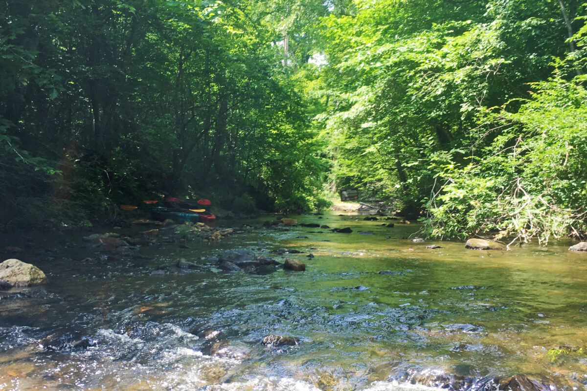
Slate River Reservoir and Holliday Lake are located within the forest, along with Holliday Creek and numerous other streams. Rock formations along Holliday Creek and the Appomattox River resemble mountain streams found farther west in Virginia.
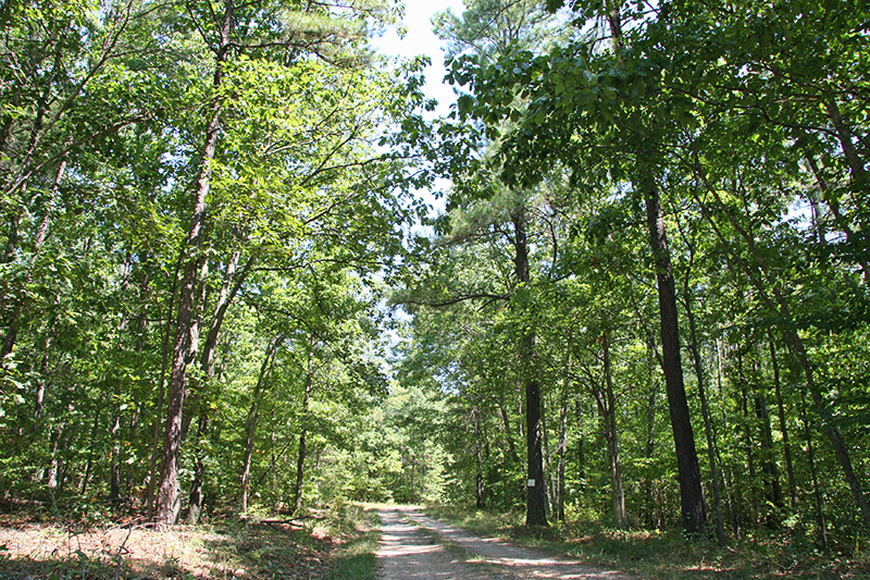
Several multi-use trails provide recreational opportunities on the forest. ABSF pays 12.5% of its revenue from timber sales to Appomattox and Buckingham Counties in lieu of taxes. The remaining 12.5% is then designated to enhance recreational opportunities on the forest.
Originally called Surrender Ground Forest, the ABSF is near Appomattox Courthouse National Historical Park, and the route of Robert E. Lee’s Civil War retreat passes through the forest. Holliday Lake State Park and Holiday Lake 4-H Center are located within the ABSF, and both Featherfin Wildlife Management Area and Horsepen Lake Wildlife Management Area are nearby.
At a Glance
Access Status: Open to the Public
Hours: Open daily from dawn until dusk
Physical Address:
Latitude/Longitude:
37° 26.050’, -78° 38.331’
Office: 1685 Francisco Road, Dillwyn, VA 23936
Access from Route 24 via routes 636, 626, 618 and 616 or from Route 15 via Route 636 or 640.
Parking/Access: Parking available at the Carter Taylor Trailhead parking area on Francisco Road
Restroom Facilities: None
Visitors are asked to adopt a “leave-no-trace” ethic when visiting the forest, as there are no restrooms or trash cans on the forest itself.
Other Facilities: 3 picnic shelters located at Carter Taylor Trailhead, Woolridge Wayside, and Lee Wayside
Seasonal Closures: None
DOF recommends that all forest visitors wear blaze orange or pink during hunting seasons.
Forest History
The Appomattox-Buckingham State Forest (ABSF) was established in 1939 as a result of Title III of the Bankhead Jones Resettlement Act. Its original purpose was to demonstrate good forest management, provide a land base for applied forest research, wildlife habitat, watershed protection, and to provide for outdoor recreation.
When the ABSF was acquired, the land was in a depleted condition, having been used almost exclusively for agriculture. The forest has continually improved as a result of the application of scientific forest management and good conservation practices. Forest growth continues to exceed harvest, site quality of previously-denuded soils has improved considerably, the quality of water originating from the forest is excellent, and biodiversity has significantly increased.
In 2011, the DOF performed a land trade with the Department of Conservation and Recreation in which DOF gave 305 acres from ABSF to increase the size of Holliday Lake State Park. In return, DOF received land from Grayson Highlands State Park in Grayson County to establish the Old Flat State Forest.
The ABSF continues to be used by exterior institutions and groups for forest research. The Virginia Department of Conservation and Recreation, Division of Natural Heritage, has established plots on unique and exemplary forest communities. Virginia Tech, as part of a consortium on climate change, has installed an extensive research project to study the effects of rainfall deficit on loblolly pine stands. Virginia Tech’s Forest Modeling Research Cooperative has installed multiple plots studying the effects of different thinning and fertilization rates on loblolly pine. The Texas Forest Service has installed several plots to study the effectiveness of systemic chemical treatment for southern pine bark beetle. Additionally, the DOF research team continues its applied forest research projects and seed orchard management on ABSF.
Since 1966, the U.S. Geological Survey has monitored water quality in Holliday Creek, one of its Hydrologic Benchmark Stations. Benchmark streams provide long-term measurements of streamflow and water quality in areas that are minimally affected by human activities. These data are used to study trends over time and to serve as controls for separating natural from artificial changes in other streams.
Historical Landmarks
The route of General Robert E. Lee’s Civil War Retreat passes through the ABSF.
A Works Progress Administration (W.P.A.) Historical Marker at the Holiday Lake 4-H Educational Center highlights the history of 1930s land management by New Deal programs and the 4-H organization in Virginia, including the 1937 rustic buildings that originally housed W.P.A. workers who built the state park and helped reforest the area.
Forest Management
The Appomattox-Buckingham State Forest (ABSF) is managed for diverse timber stands that support biodiversity, as a demonstration of scientific forest management, to protect water quality, provide forest diversity for wildlife, and create opportunities for outdoor recreation.
The forest is located in the Piedmont Plateau physiographic region of Virginia. Topography is typical of the moderately rolling Piedmont. Elevation ranges from a high point of 838 feet to a low of 390 feet with an average elevation of approximately 650 feet above sea level.
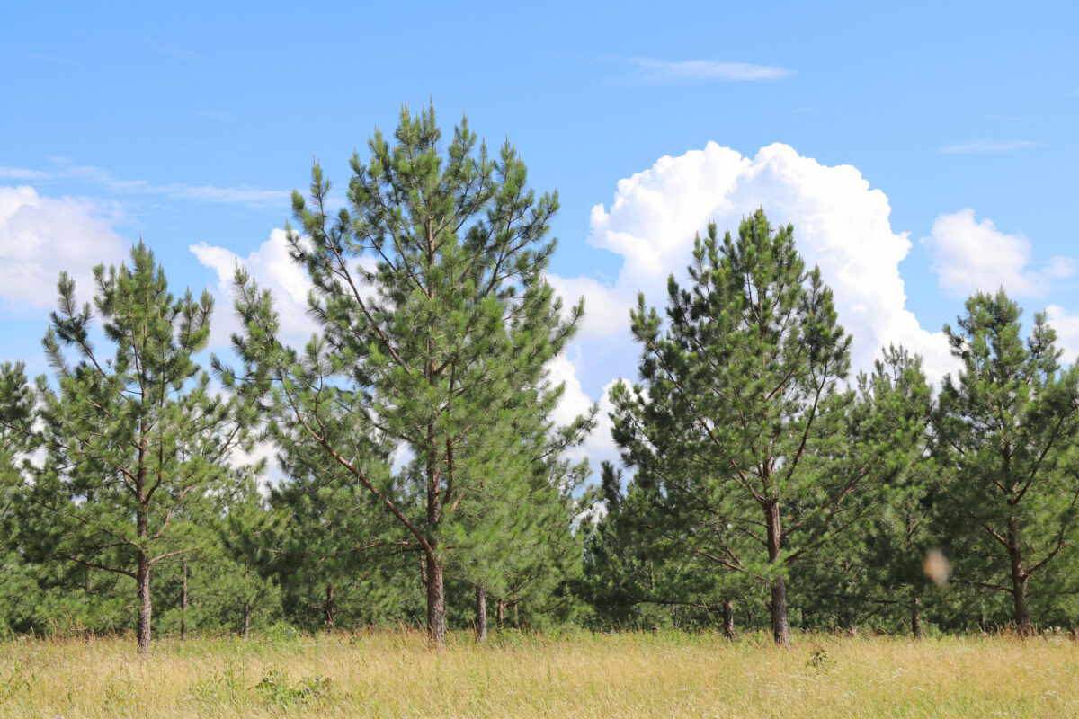
The ABSF is comprised of seven forest types, or species groups. The largest forest type, by total number of acres, is loblolly pine. Loblolly pine is the predominant species in this forest type, but Virginia and shortleaf pine also occur. The understory is often dominated by oak, hickory, and red maple; particularly in stands that have been properly thinned. The upland hardwood species group is dominated by variable groupings of white, chestnut, post, northern red, southern red, black, and scarlet oaks; mockernut and pignut hickories; yellow-poplar; red maple; and American beech. The pine-hardwood forest type is a mixture of upland hardwoods and pines – mainly Virginia and loblolly, but some shortleaf pine persists in this type. The bottomland hardwoods, while barely represented in the commercial forestland, are, nonetheless, very important on the state forest for maintaining water quality and supporting wildlife. Common species of this forest type include yellow-poplar, green ash, red maple, and sycamore. The shortleaf pine type, while covering only 4% of the forest, is very important due to this species’ diminished population across the state. The Virginia pine type is typical of much of the Piedmont; these stands colonized abandoned fields and grew very dense, often with poor quality and high mortality. Finally, three stands of planted eastern white pine grow on the forest.
Commercial timber production based on soil productivity, topographic position, environmental sensitivity, and other variables has been designated currently for 15,047 of the forest’s 19,513 acres. The majority of the difference between total and commercial acres is comprised of riparian buffers, or streamside management zones (SMZs). DOF best management practices call for a minimum 50-foot SMZ along most streams. As a general rule, state forest standard operating practice extends this minimum to 100 feet along perennial streams. Intermittent streams typically retain an SMZ of 66 feet per side. Ephemeral streams are also protected with buffers of varying widths based on adjacent topography and upstream watershed area. There is no harvest of trees within the first 50 feet of the buffer area directly adjacent to perennial streams, rivers, and wetlands. In the buffer area that runs from a measured 50 feet out to 100 feet, there may be selective timber harvest only. Timber harvest from within a riparian buffer is performed mainly to capture possible future mortality of shorter-lived species, or to address insect or disease attack. Larger buffers are maintained along Holliday Creek, the easternmost stocked trout stream in the state and the primary water source for Holliday Lake. The riparian buffers on this water course can be 300 feet or more on each side.
Recreational Opportunities
Recreational uses of the Appomattox-Buckingham State Forest (ABSF) include hunting, fishing, trapping, hiking, mountain biking, trail running, horseback riding, and wildlife watching. One of the highlights of the ABSF is the Carter Taylor Multi-Use Trailhead recreation area, which includes a parking area large enough to accommodate horse trailers, a picnic area, a non-potable well for watering horses, and a corral on Walker Forest Road, off Francisco Road.
At a Glance
Visitors are asked to adopt a “leave-no-trace” ethic when visiting the forest, as there are no restrooms or trash cans on the forest itself.
ATV/ORV use, camping, and swimming are prohibited on all State Forests.
A State Forest Use Permit is required for individuals aged 16 and older to hunt, fish, trap, horseback ride, or mountain bike on state forest lands. The permit can be purchased online or where hunting licenses are sold.
Trails and Roads
- 20 miles of forest trails (no vehicles)
- 22 miles of forest roads (vehicles allowed)
- 69 miles of gated forest roads (no vehicles)
- No driving past forest gates.
Hiking
Hiking is permitted on forest roads, Carter Taylor Multi-Use Trail, Holman/Orchard Trail, and Trout Trail.
Mountain Biking *
Mountain biking is permitted on forest roads, Carter Taylor Multi-Use Trail, and Holman/Orchard Trail.
Horseback Riding
Horseback riding is permitted on forest roads, Carter Taylor Multi-Use Trail, and Holman/Orchard Trail.
Carter Taylor Multi-Use Trailhead, on Walker Forest Road, off Francisco Road, includes a parking area large enough to accommodate horse trailers, a picnic area, a non-potable well for watering horses, and a corral.
State law requires that visitors carry a copy of a negative Coggins test report with each horse on state lands.
Fishing and Boating
Only non-motorized boats are allowed on state forest waterways. Fishing is subject to state fishing regulations and license requirements, in addition to the State Forest Use Permit.
Fishing is allowed in Holliday Creek, the easternmost stocked trout stream in Virginia. The section of the creek from Route 640 to Holliday Lake is a delayed harvest area – see Virginia Department of Wildlife Resources Delayed Harvest Waters Regulations for specific regulations about delayed harvest areas.
Boating and fishing are allowed in Slate River Reservoir, the Appomattox River, and Holliday Lake. (Holliday Lake is accessed through Holliday Lake State Park and a State Forest Use Permit is NOT required there.)
Hunting and Trapping
Hunting and trapping are permitted with a valid State Forest Use Permit and valid hunting license in accordance with state regulations, and Appomattox and Buckingham county firearms regulations. Note that some regulations may be different than on private land, so check Virginia Department of Wildlife Resources Hunting Regulations for specific state forest details.
The hunter’s map (link) shows designated safe zones (no hunting allowed) surrounding Holiday Lake 4-H Center, Holliday Lake State Park, and the DOF office on Francisco Road.
Other Recreational Opportunities
Three picnic shelters are available: Carter Taylor Trailhead on Route 636, Woolridge Wayside on Route 640, and Lee Wayside on Richmond Forest Road. Visitors should plan to pack out all trash.
Other passive recreational opportunities, such as wildlife watching and nature photography, are available.
Educational Opportunities
- Self-learning opportunities are available.
- Formal education programs are available upon request.
Tours of forest management activities for university classes and other organized groups may be arranged upon request.
DOF hosts Camp Woods and Wildlife annually for youth ages 13 to 16 on the ABSF and at the Holiday Lake 4-H Center. (link to camp web page).
Contact Us
For more information or questions, e-mail us or use our contact form.
State Forest Main Office
Located at Cumberland State Forest
751 Oak Hill Road, Cumberland, VA 23040-2511
E-mail | (804) 492-4121
Local Contact
Shannon Lewis, Forest Manager
1685 Francisco Road, Dillwyn, VA 23936
E-mail | (434) 983-2175
Maps and Additional Resources
| Image | Title | ID | Description | Date | Content Type | View | hf:tax:document-category | hf:tax:Media |
|---|---|---|---|---|---|---|---|---|
| Appomattox-Buckingham State Forest Hunting Season Brief | Information sheet summarizes hunting seasons, dates, and times for Appomattox-Buckingham State Forest. | 08/19/2025 | Document | View | state-forests | document | ||
| Appomattox-Buckingham State Forest – Hunting Map | Hunting map of Appomattox-Buckingham State Forest. To ensure your safety and enjoyment, please read Before You Visit when planning your trip to a state forest. Download or print this state forest map – many state forests are remote with limited cell phone service. These maps will work with Avenza Maps™, a mobile map app that allows you to track your movements offline on your iOS and Android device without the need for cell service or internet connection. A free version of this app can be downloaded to your device through your app store. | 08/28/2023 | Map | View | state-forests | map | ||
| Appomattox-Buckingham State Forest – General Map | General map of Appomattox-Buckingham State Forest. To ensure your safety and enjoyment, please read Before You Visit when planning your trip to a state forest. Download or print this state forest map – many state forests are remote with limited cell phone service. These maps will work with Avenza Maps™, a mobile map app that allows you to track your movements offline on your iOS and Android device without the need for cell service or internet connection. A free version of this app can be downloaded to your device through your app store. | 08/24/2023 | Map | View | state-forests | map | ||
| Appomattox-Buckingham State Forest Recreation and Trails Map | P00171 | Map introduces recreation and trails, including trail segments, descriptions and distances, located on the Appomattox-Buckingham State Forest in Appomattox and Buckingham counties. | 06/01/2009 | Publication | View | state-forests | publication |