Overview
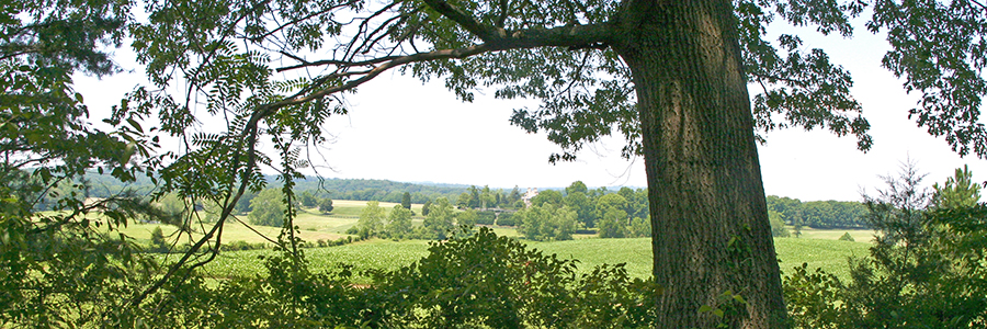
The 148-acre Whitney State Forest is located in Fauquier County. Management focuses on demonstration of scientific forest management, applied forest research, diverse wildlife habitat, watershed protection, forest management to develop diverse timber stands that support biological diversity, and opportunities for passive outdoor recreation.
Fauquier silt loam is the primary soil type found throughout the forest, encompassing approximately 80% of the total area. This soil is defined as a well-drained, moderately acidic soil with an above average productivity rating for tree growth when compared to other soils commonly found in this region. Several intermittent and perennial streams exist on the property.
At a Glance
Access Status: Open to the Public
Hours: Open daily from dawn until dusk
Physical Address:
Latitude/Longitude:
38° 40′ 19.6″, -77° 48′ 20.5″
Approximately 3 miles south of Warrenton, on the west side of Route 684.
Parking/Access: One small parking area at the entrance on Route 684.
Restroom Facilities: None
Visitors are asked to adopt a “leave-no-trace” ethic when visiting the forest, as there are no restrooms or trash cans on the forest itself.
Other Facilities: None
Seasonal Closures: The forest is occasionally closed for a managed lottery deer hunt.
The Whitney became a state forest in 1972, by gift from Mrs. Gibson in memory of her parents, Charles and Alice Whitney.
Historical Landmarks
The old stone house remnants on the forest were part of the home of Henry Washington Ashton.
At a Glance
Visitors are asked to adopt a “leave-no-trace” ethic when visiting the forest, as there are no restrooms or trash cans on the forest itself.
ATV/ORV use, camping, and swimming are prohibited on all State Forests.
A State Forest Use Permit* is required for individuals aged 16 and older to hunt, fish, trap, horseback ride, or mountain bike on state forest lands. The permit can be purchased online or where hunting licenses are sold.
Trails and Roads
- 7 miles of forest trails (no vehicles)
- 1 mile of gated forest roads (no vehicles)
- No driving past forest gates.
Hiking
Hiking is permitted on all forest roads and trails.
Mountain Biking *
Mountain biking is permitted on forest roads and trails.
Horseback Riding *
Horseback riding is permitted on all forest roads and trails. There is limited parking available for horse trailers.
State law requires that visitors carry a copy of a negative Coggins test report with each horse on state lands.
Fishing and Boating
None
Hunting and Trapping
A lottery hunt is occasionally conducted. Hunting with lottery permit, valid State Forest Use Permit, and valid hunting license in accordance with state regulations. Note that some regulations may be different than on private land, so check Virginia Department of Wildlife Resources Hunting Regulations for specific state forest details.
Lottery Hunt
No scheduled lottery hunts at this time.
Other Recreational Opportunities
Other passive recreational opportunities, such as wildlife watching and nature photography, are available.
- Self-learning opportunities are available.
- Self-guided educational opportunities – interpretive signs.
Explore tree and wildlife identification, or simply observe nature. The forest demonstrates forest management, harvesting techniques, and best management practices to landowners, loggers, and industry professionals.
Local schools can use the state forest for educational purposes.
State Forest Main Office
Located at Cumberland State Forest
751 Oak Hill Road, Cumberland, VA 23040-2511
E-mail | (804) 492-4121
Local Contact
Jack Kauffman, Forest Manager
900 Natural Resources Drive, Suite 800, Charlottesville, VA 22903
E-mail | (540)395-1226
| Image | Title | ID | Description | Date | Content Type | View | hf:tax:document-category | hf:tax:Media |
|---|---|---|---|---|---|---|---|---|
 | Whitney State Forest – General Map | General map of Whitney State Forest. To ensure your safety and enjoyment, please read Before You Visit when planning your trip to a state forest. Download or print this state forest map – many state forests are remote with limited cell phone service. These maps will work with Avenza Maps™, a mobile map app that allows you to track your movements offline on your iOS and Android device without the need for cell service or internet connection. A free version of this app can be downloaded to your device through your app store. | 08/15/2023 | Map | View | state-forests | map |